


Your simple yet strategic solution to agricultural business management tailored especially for your property and ag business.


CULTURE AND STRATEGY
ALIGNMENT IN AGRICULTURE
“What are you in the business of?
Whether you’re an expert at growing wheat, cotton, sheep, barley or brahmans, you’re still in business.
Let’s take care of it, together.”
- Lisa Ferguson, CHRRUP Business Development Lead
Taking care of business is what we’re about, helping you get on with what you’re about – growing, mustering, fencing, harvesting, planting, irrigating, fire breaking… farming.
Smart Station is CHRRUP’s newest business arm, designed to deliver a simple yet comprehensive range of tools and resources to assist in the effective management of agricultural businesses Australia wide.
We help take the overwhelm out of the business realm of your farming practice, by tailoring simple and manageable best practice processes around:
- Human Resources (we know, it’s ok, we got you!)
- Culture and Strategy alignment
- Record keeping
- Property Mapping
- Branding and marketing
- Business and resilience planning
You can also keep up to date by subscribing to our free newsletter and podcast (returning soon!).
At CHRRUP, we don’t really believe in Human Resources. Rather, we believe in resources FOR humans – not humans as a resource.
Which is why we have developed a bunch of recruitment, selection and hiring tools for YOU as the first human in your ag business, to help you attract, develop and return a strong workforce of fellow humans and team players.
We have sifted and sorted through the rules and regulations around hiring for you – so you don’t have to. Fun, light reading material like the Fair Work Act 2009, Anti-Discrimination Act 1991 (Qld) and yeah - it’s dry like a drought. But what we HAVE done off the back of this wonderful adventure through legislation is developed templates and tools and resources that are compliant, relevant and applicable to your ag business.
You’re welcome.
ATTRACTING, DEVELOPING AND RETAINING TOP SHELF HUMANS
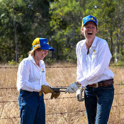
resources for humans in ag
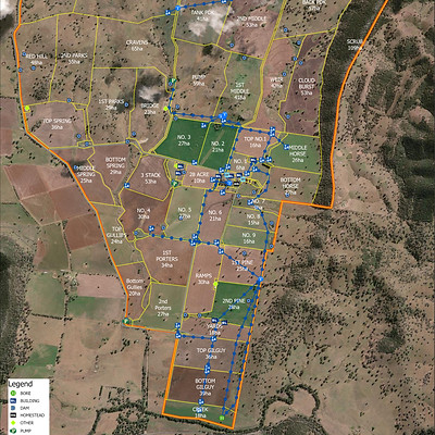
Whole property & mini maps
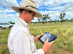
Property mapping
CHRRUP offers a property mapping service. These maps are a practical tool which can aid in property infrastructure and production decisions.
The program that CHRRUP uses is ArcGIS Pro which allows us to create high quality maps with the latest imagery available. We work one on one with producers to develop the map and ensure it is accurate and meets their expectations.
Included in our mapping service is an A3-A0 laminated map. You will also receive a digital copy (jpeg, KML and/or shape file) that you can import into an online mapping tool such as Google Earth and QLD Globe. This allows you to make updates and utilise the layers to help make sound production decisions.

CHRRUP provides a whole property map of existing and proposed infrastructure plus mapping layers such as grazing radius, land types, contours, water courses and drainage systems.
These maps can help with:
-
Infrastructure development planning
-
Grazing and cropping management
-
Staff and contractor inductions
-
Operational planning
-
Keeping everyone informed
Mini
Maps
CHRRUP provides specific infrastructure and focused area maps to scale.
For example:
-
Feedlots
-
Yards
-
Paddocks
-
Proposed developments
Whole Property Maps
mapping FAQs
Frequently asked questions
